Sideroads: San Juan CR 18 to Well-Preserved Mining Site

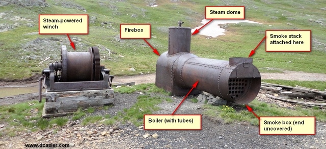
Steam-powered winch

Steam-powered winch at Mining Site A, remarkably intact

 
You can probably tell by the lead-in photo that this post will be rather technical. There’s a sideroad off of the Engineer Pass road—I can’t tell you how many times I’ve passed it by! On July 22nd I was in a mood to explore side roads and this one presented itself. It’s San Juan CR 18 (different from Ouray CR 18!) and is located between the turnoff up to Engineer Pass and the Animas Forks ghost town. The exact coordinates are shown on the GPS map at the bottom. This is what you’ll see Continue reading

Posted in GPS Tracks, Motorcycling, San Juan County | Tagged , | 4 Comments

Wildflowers in Yankee Boy Basin: For Mom


So why do I put so many wildflower pictures on the site? Because my Mom loves them, that’s why! She’s 86 and lives in Southern California. She’s computer literate and loves the beauty of the Colorado wildflowers. This video was taken last Thursday (July 28) at Yankee Boy Basin, outside of Colorado. The end of July is usually the peak wildflower season, and a combination of heavy snow and frequent summer rains has given us the best set of wildflowers I’ve ever seen. Enjoy!

Posted in Ouray County, Video, Wildflowers | Tagged | Comments Off on Wildflowers in Yankee Boy Basin: For Mom

Origami: Folding a Dollar Bill to Look Like a Shirt


What’s this, you ask? Yep, it has nothing to do with motorcycles or ham radio, but after all this is my information site. My mom has made it a tradition for many years to include in the Happy Birthday card a $20 bill made into the shape of a shirt using an origami technique. I thought I’d make a short video showing how this is done. Enjoy! — Update Aug 17th, 2011 from my mother:

The sleeves are the last thing to be made. With the folded shirt facing up, untuck the front of the shirt from under the collar, turn over and lift up inside flap so you have one long folded strip with the back of the collar at the bottom. With the middle fingers, reach around both sides of the top fold and pull out narrow sides and continue crease all the way across. This is what will make your sleeves. With thumb and first finger, pinch a sleeve out, adjust the size, and there you have it!

Posted in Video | 1 Comment

Great Ride with Blog Reader John Fischer

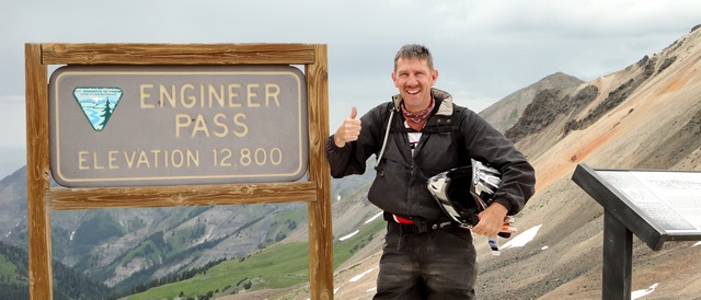
John Fischer at Engineer Pass

Reader John Fischer wanted high country. He got high country. This is John at Engineer Pass.


John Fischer got in touch with me a few months back. He’s an avid reader of this blog and hoped we’d be able to ride together while he was out here for vacation. We did just that! John hails from Michigan and asked for alpine views, so we Continue reading

Posted in GPS Tracks, Motorcycling, Ouray County, San Juan County, San Miguel County | Tagged , , , , , , | 2 Comments

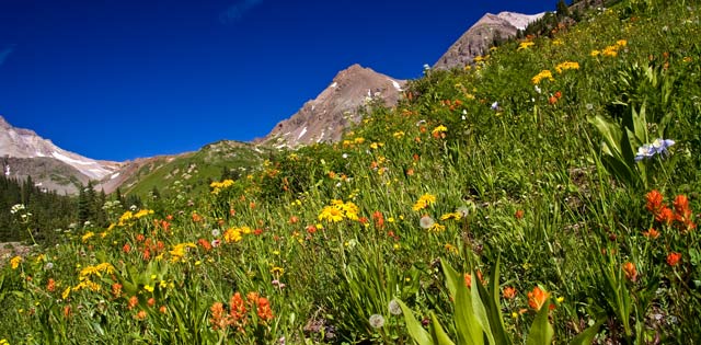
Yankee Boy Basin Wildflowers

Wildflowers in Yankee Boy Basin

Wildflowers everywhere in Yankee Boy Basin


Loretta and I were at Yankee Boy Basin today. I’ve never seen the wildflowers as thick and gorgeous as this! And there were many columbines—so many I put them all in another post (see this). This post has more wildflowers—there were so many to choose from! Continue reading

Posted in Ouray County, Wildflowers | Tagged | Comments Off on Yankee Boy Basin Wildflowers

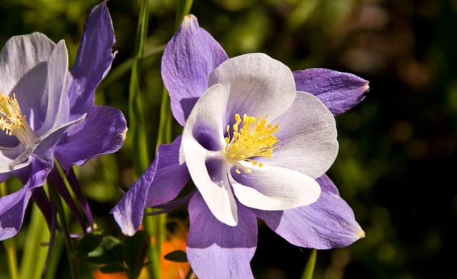
Yankee Boy Basin Columbines

columbines in yankee boy basin

Closeup of a columbine in Yankee Boy Basin


Today is my 60th birthday, and to celebrate my wife and I went up to Yankee Boy Basin outside Ouray. I’ve never seen the wildflowers so thick and beautiful—the combination of heavy snow and recurring rainfall has done wonders! I ended up with so many columbine pictures I thought I’d devote a post just to them. So enjoy! Continue reading

Posted in Ouray County, Wildflowers | Tagged , | Comments Off on Yankee Boy Basin Columbines

High Country Etiquette: The Good, Bad, and Ugly

After three years, I finally encountered my first example of high country road rage. So sad… But I also encountered several groups of great people all associated with the FJ Summit (more later).

Yesterday (Friday) found me way in the high country, going up Ouray County Road 18, stopping at Engineer Pass and Animas Forks, Picayune Gulch and Placer Gulch, California Pass, Hurricane Pass, and Corkscrew Pass. I also took in several side roads and will post on those separately.

The rules

But…let’s review the rules: Many, many people love visiting the high country in the summertime, and the end of July/beginning of August is high season. The roads are rough and in many places very narrow. The vehicle going uphill has the right of way (because it’s safer to back up a hill than to back down a hill). But…and the authorities emphasize this, use common sense! The roads are shared by Jeeps/Jeep-equivalents, ATVs, UTVs (like an ATV but with side-by-side seating–becoming popular), and motorcycles. In general, a motorcycle must travel faster (8 to 10 mph minimum) to stay upright. Continue reading

Posted in Motorcycling, Ouray County, San Juan County | Tagged , , | Comments Off on High Country Etiquette: The Good, Bad, and Ugly

Owl Creek Pass Meanderings and GPS Track

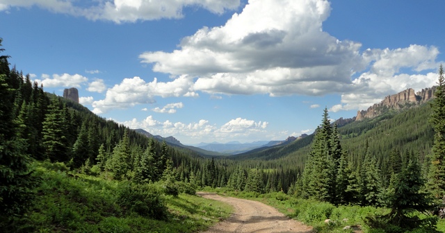
West Fork road view

Looking north from the road along the west fork of the Cimarron River. The view goes on forever!


This afternoon I headed up and over Owl Creek Pass to visit some friends who are camping on the Middle Fork of the Cimarron River. Along the way I meandered a bit and collected some interesting photos. The one at the top is taken from the road along the West Fork of the Cimarron River. When I came around the corner and saw this I stopped cold, turned off the engine, and just enjoyed the view. I wish you could have been Continue reading

Posted in GPS Tracks, Gunnison County, Motorcycling, Ouray County | Tagged , , , , | 1 Comment

Owl Creek Wildflowers

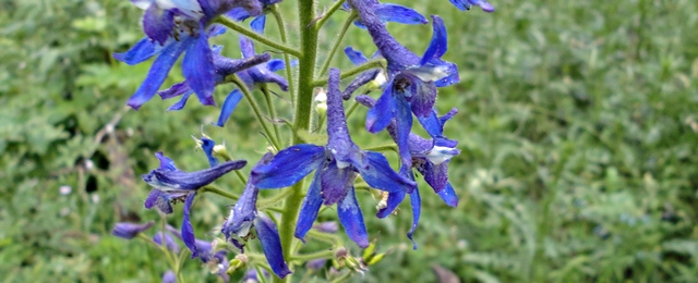
Subalpine Larkspur

Subalpine Larkspur, found this evening while on the double-track from Vista Point to Stealey Mountain Trailhead


I was up and about Owl Creek Pass this evening and opted to take the doubletrack trail from Vista Point to Stealey Mountain Trailhead, normally a nice, easy trail. Well, the wet spring and heavy runoff we’ve had this year has roughed the trail up. But I did find wildflowers. As I was going through an area under some aspens, the subalpine larkspur (see above) caught my eye—at first I thought they were blue faerie trumpet Continue reading

Posted in Motorcycling, Ouray County, Wildflowers | Tagged , , | Comments Off on Owl Creek Wildflowers

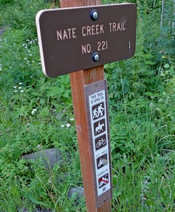
Nate Creek Trail Singletrack Open to Dirt Bikes

Nate Creek Trailhead

Nate Creek Trail No. 221 trailhead sign

I stopped this evening at Owl Creek Pass to chat with a motorcyclist (dirt bike) from Telluride. He was looking for Nate Creek Trail and was worried that the trail had been closed. I was on the trail two years ago and followed it for about three miles—parts are easy but there are several intermediate-to-hard parts. I’m told it connects with a technically-challenging (expert-level) single-track that goes up over Lou Creek Pass and connects with a double-track trail that comes out at Silverjack Reservoir’s middle fork.

Well, the trail is still there. I snapped the picture at the left this evening. The trail is open year-round to hikers, horses, and bicycles. The trail is open from July 4th to Labor Day to motorcycles.

So, just where is this place? Here are the answers:

  • N38° 10.5593′ by W108° 35.5376′
  • Traveling east, from the Forest Service boundary up to the trailhead is 2.8 miles
  • Traveling west, from Owl Creek Pass (the actual pass, as marked by the sign) down to the trailhead is 4.9 miles
  • If you’re getting there from Ridgway, the distance from the intersection of Ouray CR 8 and Ouray CR 10 to the trailhead is 6.7 miles

I don’t recommend this trail if you’re alone. Most certainly, do not attempt Lou Creek Pass alone!

Posted in Motorcycling, Ouray County | Tagged , , | 1 Comment