Dry Creek Canyon, Montrose, CO

Road into Dry Creek Canyon

Road into Dry Creek Canyon. Rim Road is on...the rim! Where the road dips down along the canyon wall, that's point C on the GPS map.


On July 8th, Woody Woodrum and I met at a spot (see Point A on map) about 1/3 the way from Montrose up to the National Forest area of the Uncompahgre Plateau, which makes this BLM land. I had no idea the area held cool and challenging trails, but Woody had been here before and wanted me to see it. I’m glad Continue reading

Posted in Montrose County, Motorcycling | Tagged , | 2 Comments

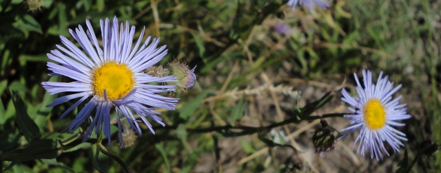
Wildflowers along Ouray County Road 4

Blue aster along Ouray County Road 4

Blue aster along Ouray County Road 4


I rode up Ouray County Road 4 this afternoon and found many wildflowers, especially near the top—wildflowers everywhere! Not all of my pictures were in focus—rats! But here are four for you to look at. Continue reading

Posted in Ouray County, Wildflowers | Tagged , , , | Comments Off on Wildflowers along Ouray County Road 4

Road Updates: CR 2, 4, Lower Powerline Road

I had the XT-250 out this evening. Here’s a quick road status:

  • Ouray County Road 4: Open, no mud, but the recent rains have torn it up pretty badly—watch for loose rocks where there weren’t any before. I took wildflower pics at the top which are in a separate post.
  • Ouray County Road 2 and 2B: Not too bad, a bit of rain damage—watch for ruts, eminently navigable.
  • Lower Powerline Road: Open, a few parts torn up by rain, a bit of mud here and there, but perfectly navigable
  • Buckhorn Road (see separate post). Open, some rutting toward top, some mud—watch where you put your tires! Lots of insects around the lakes. Some of the campsites are pretty muddy but others are okay.
Posted in Montrose County, Motorcycling, Ouray County | Tagged , , , | Comments Off on Road Updates: CR 2, 4, Lower Powerline Road

Buckhorn Lakes: Open with Wildflowers and Bugs!

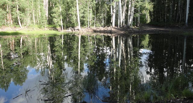
Still waters at Buckhorn Lakes

Still waters at Buckhorn Lakes. There wasn't a whisper of wind, around 6:30 p.m., permitting these delightful reflections in the water.


I was out and about on the XT-250 this afternoon and am pleased to report that the road to Buckhorn Lakes (there are two lakes right next to each other) is open. Toward the top there is rutting and a bit of mud, and some of the campsites are pretty muddy. The campsites on this Wednesday evening are empty—lots of room. But do bring your bug spray. I had to stop at one point, take off my helmet, get the bug out of my ear, put my helmet back on, and snap the visor tight! Below are some more pictures: my first columbine blossom, a majestic view of a thunderstorm, and yours truly standing by one of the lakes. Continue reading

Posted in Montrose County, Motorcycling, Wildflowers | Tagged , , | Comments Off on Buckhorn Lakes: Open with Wildflowers and Bugs!

Last Dollar Road GPS Map and Directions

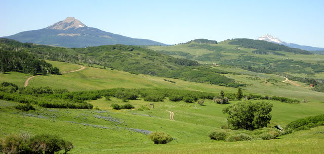
Last Dollar Road View

Last Dollar Road view from just south of Point B. This is the springtime view. In the fall those aspens turn gold. That's a private ranch road down there—Last Dollar Road is behind you.


Last Dollar Road was on my agenda last Friday and it didn’t disappoint. It’s open, dry, and easily traversable, though there are a few ruts and some tiny stream crossings. I’d hesitate to recommend this road for a 2WD passenger car, but everything else should be okay. The GPS track that follows is by far the best I’ve obtained to date: Continue reading

Posted in GPS Tracks, Motorcycling, San Miguel County | Tagged , | 2 Comments

Wildflowers along Last Dollar Road

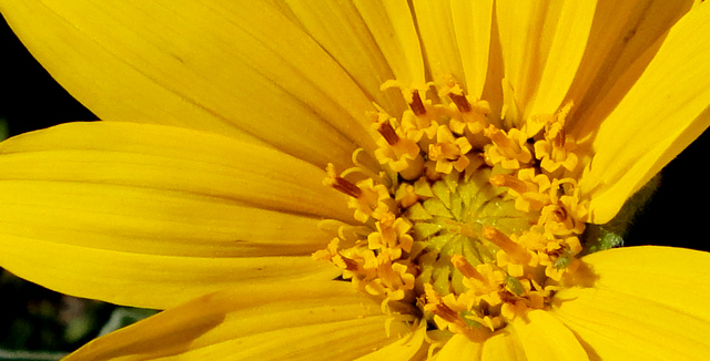
Yellow flower along Last Dollar Road

Yellow flower along Last Dollar Road


I was 9-1/2 hours in the saddle yesterday and covered many passes. And…took lots of wildflower pictures. This post shows wildflowers along Last Dollar Road taken in two places: near Last Dollar Ranch and much further up at a spot looking west. Without further ado: Continue reading

Posted in San Miguel County, Wildflowers | Comments Off on Wildflowers along Last Dollar Road

More passes open, but watch for mud

I completed a gigantic loop yesterday. I’ve many maps and pictures (including many wildflowers) to post. Here’s the quick status of roads open and, well, almost open.

  • Last Dollar Road from Dallas Divide to Telluride is open and fairly dry. A bit rutted. Lots of wildflowers.
  • Alta Lakes Road is open (off Colorado Hwy 145, south of Telluride). You can get either to the lakes or to Gold King Basin.
  • Galloping Goose Trail, open from near the Matterhorn Campground all the way past Trout Lake and up to Lizard Head Pass.
  • Ophir Pass is open, fairly dry, with a handful of mud on the east side. There is one creek on the west side that you must ford that’s got lots of water, but it’s not very far across.
  • San Juan County Road 14 is ostensibly open, meaning the snowplow has been through, but very, very muddy in spots. Given how steep it is this can make going tricky. I’d let this one dry out a bit.
  • Ouray County Road 31, which goes through the Red Mountain Mining District, is “open” but very rutted and very, very muddy. I came across a pickup truck very thoroughly stuck in a mudhole.
Posted in Motorcycling, Ouray County, San Juan County, San Miguel County | Tagged , , , , | 2 Comments

Ouray County Road 18: to Engineer Pass

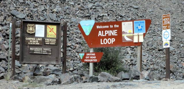
West entrance to Ouray County Road 18, part of the Alpine Loop

West entrance to Ouray County Road 18, part of the Alpine Loop. This is what you see to the left of the road entrance. See next photo for what you see to the right.


The most direct route from Ouray to Engineer Pass is to travel a few miles south of Ouray on US Hwy 550, then turn left onto County Road 18. I am pleased to report that this route is open and you can go all the way to Engineer Pass, or down into Animas Forks and thence to Silverton. I am also pleased to report that I traversed this road from east to west on Tuesday evening and did not die Continue reading

Posted in GPS Tracks, Motorcycling, Ouray County, San Juan County | Tagged , | 1 Comment

Corkscrew Pass: Ouray County Road 22A

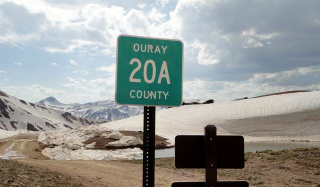
Corkscrew Pass Ouray CR 20A

The view from the top of Corkscrew Pass looking west. This is the boundary between Ouray and San Juan Counties. To the west is Ouray CR 20A, which takes you down to US Hwy 550.


As noted in an earlier post, Corkscrew Pass is now open between US Hwy 550 and San Juan CR 10. I traveled it yesterday late afternoon on my Yamaha dirt bike. I must say it was a bigger challenge than Continue reading

Posted in GPS Tracks, Motorcycling, Ouray County, San Juan County | Tagged , , , | 2 Comments

San Juan CR 22: Nifty and fun diversion

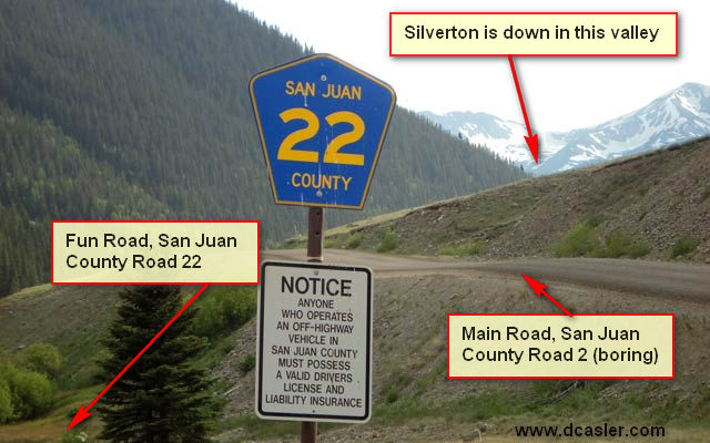
San Juan County Road 22

This is what you see traveling southwest along San Juan CR 2 from Animas Forks to Silverton. CR 22 parallels CR 2 for a couple miles. See the GPS map below.


I discovered this nifty diversion by accident. Last year I was heading from Animas Forks ghost town to Silverton. San Juan CR 2 is somewhat interesting from Animas Forks south to Eureka (bumpy but passable by any vehicle if Continue reading

Posted in GPS Tracks, Montrose County, San Juan County | Tagged , , | Comments Off on San Juan CR 22: Nifty and fun diversion